

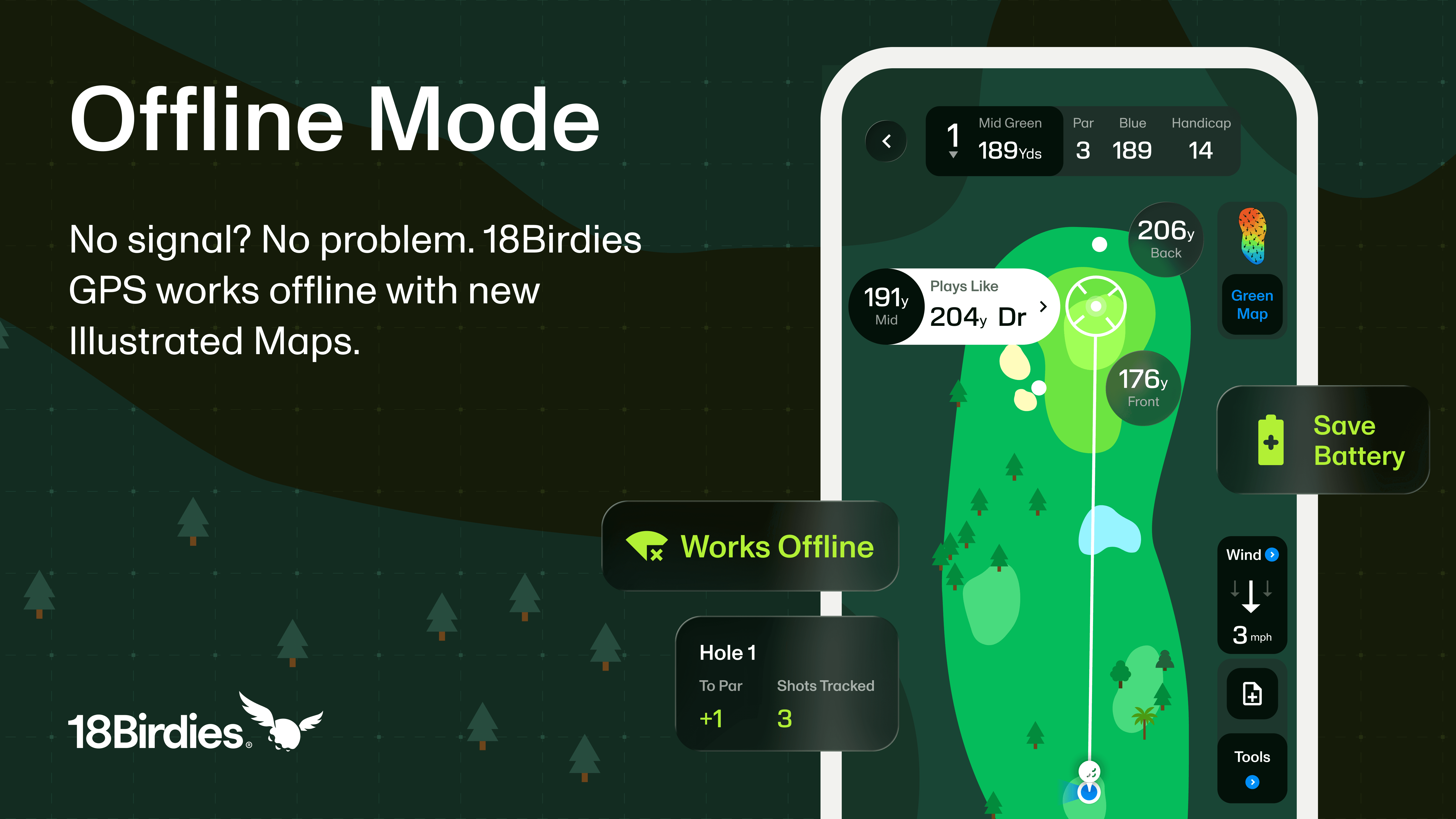
Meet Offline Mode
The anticipation for a new course starts long before the first tee. You scroll through photos on social media, explore the layout in Course Preview, and imagine the shots you want to hit.
Then you arrive, start your round while service is still available, and the same remote setting that makes the course special leaves your phone with one unreliable bar. The satellite image stalls, the map will not load, and excitement turns into frustration before the opening tee shot.
Nearly one in three golfers told us they run into on-course service trouble occasionally or often, so we built Offline Mode. Illustrated Maps provide a clean, lightweight course view while keeping your GPS distances and round tools available when satellite imagery cannot load.
Playing Today?
Start your round while you are connected and have Illustrated Maps ready if the course takes you beyond reliable service.
A Different Map, Built for the Same Round
Satellite Maps offer a familiar aerial view of the course, but that imagery needs a dependable connection to load reliably. Illustrated Maps use course layout data to give you a clear view of the hole without asking the app to continually load satellite photography.
There is no separate course library to search and no map file for you to manage or download. The Illustrated Map data is loaded and saved automatically when you start the round with service, so the option is there when the course takes you into a dead zone. Starting a new round still requires an internet or cellular connection.
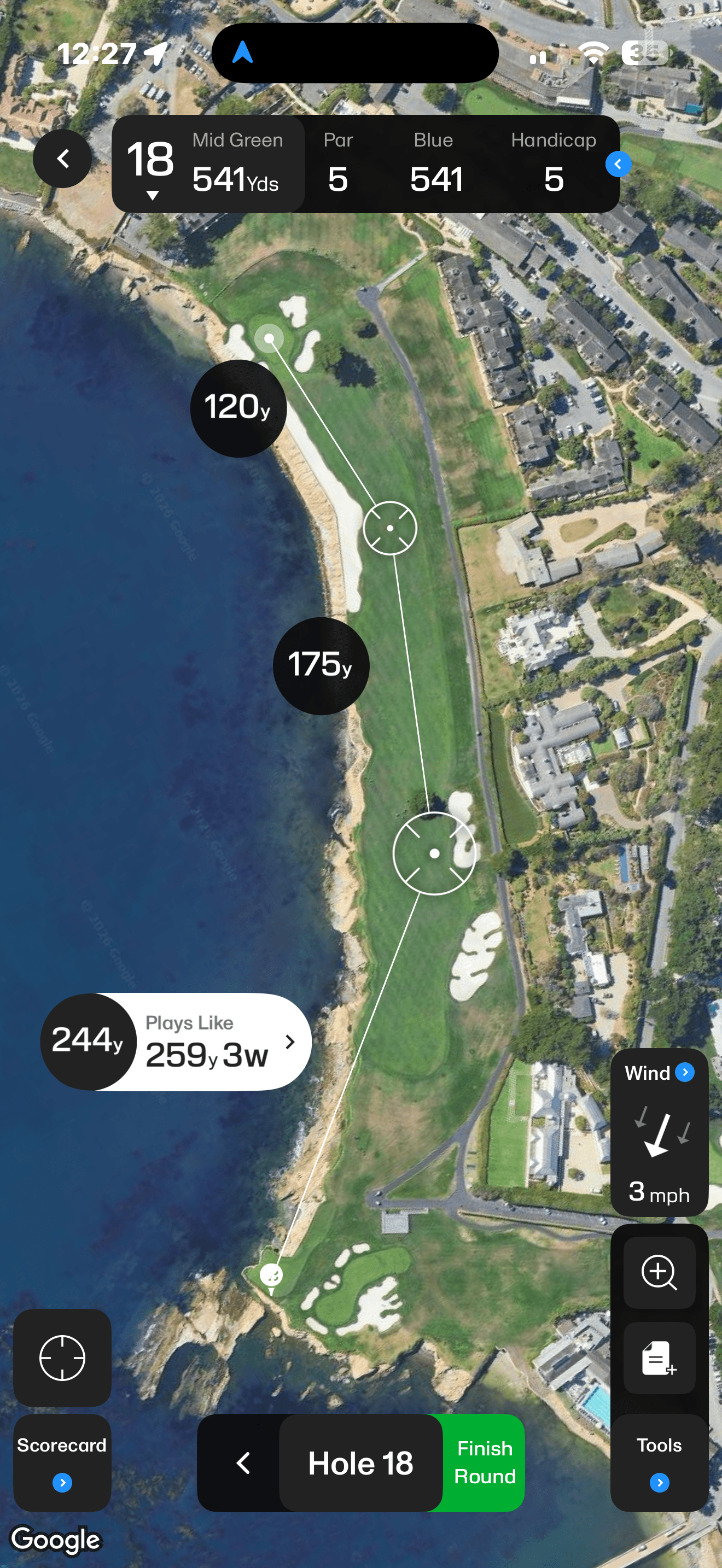
The aerial view you know
Pebble Beach Hole 18 shown with satellite imagery when your connection is strong.
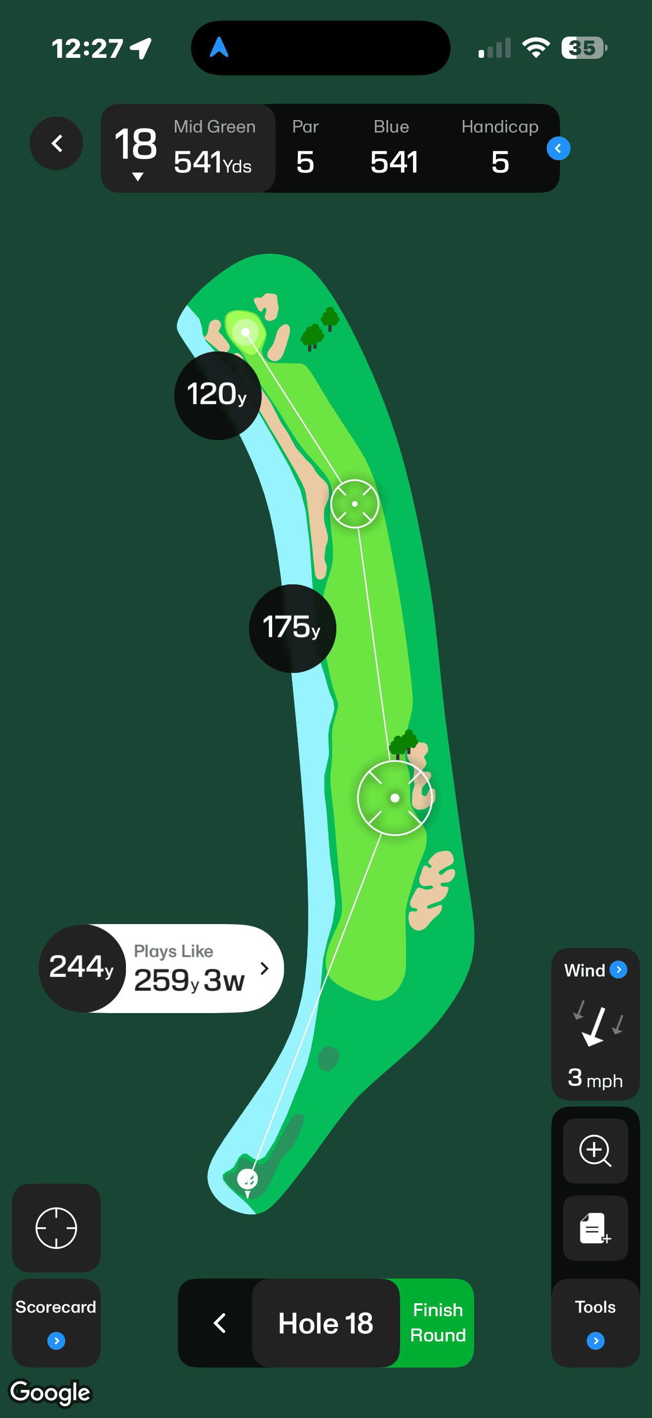
The reliable alternative
The same hole shown as a clean illustration when satellite imagery cannot load.
How to Turn On Offline Mode
You can move from the Satellite Map to an Illustrated Map at any point during a round. The control lives in the same GPS Tools menu you already use, so changing the view only takes a few taps.
- 1Start your round in 18Birdies as usual.
- 2Tap Tools.
- 3Select Map Layers.
- 4Choose Illustrated Map.
- 5Tap Save to update the course view.
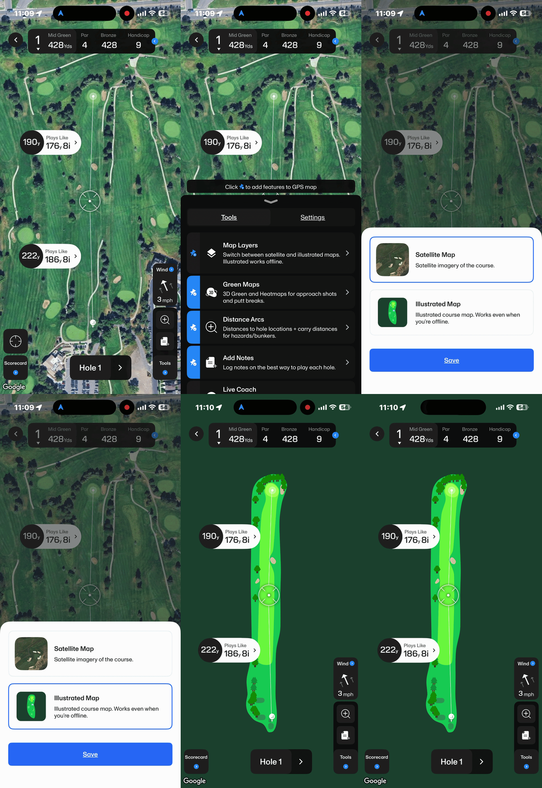
Want the aerial view again? Follow the same steps, choose Satellite Map, and save your selection. You can move between map layers during the round as conditions or your preference change.
What Happens When Your Signal Drops Mid-Round?
Sometimes you know a course has dead zones before you reach the first tee. Other times, the signal disappears without warning halfway through the back nine. If 18Birdies detects that your connection is too weak to load the Satellite Map reliably, the app can prompt you to switch views.
Tap “Switch to Illustrated Map”
The course view changes without sending you away to download or manage anything. If your connection improves later, you can return to the Satellite Map whenever you want.
Why Illustrated Maps Matter Beyond a Lost Signal
Offline Mode solves the obvious problem: using a map when service is unreliable. The new layer is useful well beyond that too. It gives every golfer another way to view the course and choose whichever picture works best for the round in front of them.
Your Home Course Has Dead Zones
You already know the holes where service fades. Start the round while connected and the Illustrated Map data is saved automatically, with no separate course-map library to download or manage.
You Are Playing Somewhere Remote
Mountain courses, rural layouts, desert golf, and destination rounds can deliver unforgettable holes without dependable cell coverage. Illustrated Maps help keep the course visible when satellite imagery cannot load.
The Satellite Image Looks Outdated
Courses evolve. Renovated greens, moved bunkers, and redesigned holes do not always appear in aerial imagery right away. The Illustrated Map gives you another view of the layout.
You Prefer a Simpler Course View
You do not have to wait for poor service. Choose the cleaner illustrated layer whenever it gives you a better picture for planning the next shot.
See Your Course a New Way
Find the course you are playing, start your round, and bring up its Illustrated Map when you need a clearer, connection-friendly view.
Does 18Birdies GPS Work Offline?
Yes, after you start the round while you still have internet or cellular service. Once the round begins, the Illustrated Map data is saved so you can keep using the course view if service becomes weak or disappears.
Most core round features remain available, including GPS distances, club recommendations, score and stats input, and shot tracking. Scores, stats, and shot-tracking data recorded while offline will sync to 18Birdies after your connection returns.
Apple Watch maps follow the same pattern. If you start the round with service, the watch can continue using the same Illustrated Map data offline.
Built for Wherever Golf Takes You
Great golf has a habit of taking you away from everything: into the mountains, through the trees, across miles of open land, and onto courses where your phone might show one bar of service if you are lucky.
With Offline Mode and Illustrated Maps in 18Birdies, losing your signal does not have to mean losing your course view. Because sometimes the courses with the worst cell service are the ones most worth playing.
Next Time the Signal Drops, Keep Playing
Start your round while connected, then switch to an Illustrated Map if service drops. Your next decision should be about the shot, not your cell service.
Try Illustrated Maps in Your Next RoundOffline Mode FAQs
What is Offline Mode in 18Birdies?
Offline Mode is an Illustrated Map layer in 18Birdies that provides a clean course layout when satellite imagery cannot load reliably. It is designed to keep the GPS round experience available in areas with weak or no cell service.
Does 18Birdies GPS work without cell service?
Yes, after the round has been started while you still have internet or cell service. Start your round while connected. Once the round begins, the Illustrated Map data is saved so you can continue using the course view and most core round features if service drops.
Do I need to download a golf course before my round?
No. There is no separate course library to search and no map file to manage or download. The Illustrated Map data is loaded and saved automatically when the round is started with service.
How do I turn on Offline Mode in 18Birdies?
During a round, tap Tools, select Map Layers, choose Illustrated Map, and tap Save.
Can I switch back to the Satellite Map?
Yes. Return to Tools, open Map Layers, select Satellite Map, and save your choice. You can change map layers during the round.
What happens if my connection becomes weak during a round?
If 18Birdies detects that the connection is too weak to load satellite imagery reliably, the app can prompt you to switch to the Illustrated Map so you can continue the round.
What stays available when I use an Illustrated Map?
Most core round features remain available, including GPS distances, club recommendations and shot tracking, plus score and stats input. Scores, stats, and shot-tracking data recorded while offline will sync after service returns.
When should I use an Illustrated Map?
Use an Illustrated Map when a course has spotty service, when you are playing in a remote or rural area, when satellite imagery does not reflect the current course layout, or whenever you prefer a cleaner map view.
Do Illustrated Maps work offline on Apple Watch?
Yes. Apple Watch Map View can continue working offline when the round was started with service. The watch and phone use the same Illustrated Map data.
